
Trace a Los Angeles Street
A street-by-street search is a chain, not one name lookup. Start with the exact address and ask what each custodian can prove. The path is address to owner, owner to deed, deed to permitted voter evidence, and then to a historical reverse directory. The Assessor supplies the parcel key. The recorder supplies title parties after a name and year are known. A directory supplies a time-stamped listing.
- Run the address through the Los Angeles County Assessor Portal. Record the situs, AIN, legal description, year built, and parcel facts.
- When an owner is needed, use the Assessor's non-web channel. The public card has no owner-name search or public owner mailing address.
- At the RR/CC index, search that party as grantee in the likely acquisition year. Record the grantor, document number, date, and legal description.
- Use voter self-verification only for a known person's own match. An address alone cannot produce a public voter list.
- Search the same street in a reverse or criss-cross directory. Compare its address sequence with deeds, census material, newspapers, and permits.
The chain separates an owner, an occupant, a recorded party, and a historical listing. That distinction supports a careful Los Angeles street directory.
Los Angeles Street Address to AIN
The Los Angeles County Assessor Portal opens with Basic Search, Legal Search, and Map Search. Its unified field is “Search by AIN or Address.” The AIN is a ten-digit parcel identifier, often displayed as a Book-Page-Parcel such as 5190-018-032. The public interface has no owner-name field.
| Assessor or GIS field | Type | Required | Format or use |
|---|---|---|---|
| Search by AIN or Address | Autocomplete text | Yes | Ten-digit AIN or street address. |
| Basic Search | Tab or button | Not applicable | Address and AIN parcel lookup. |
| Legal Search | Tab or button | Not applicable | Tract, block, lot, or legal-description path. |
| Map Search | Tab or link | Not applicable | Pan, zoom, and select visible parcels. |
| ZIMAS Property Address | Address text | Not stated | House number and street for a city parcel. |
| GIS-NET Address, AIN, or Intersection | Text or map field | Not stated | County searches, chiefly for unincorporated territory. |
Use Basic Search first. Legal Search helps when a tract, block, or lot survives a street-name change. Map Search helps with corner parcels, new construction, and failed autocomplete. Cross streets can locate a missed parcel. Assessor help points researchers to helpdesk@assessor.lacounty.gov with the AIN and address. Owner information is also available without charge at district offices or through Property Data Sales.
Los Angeles Street Parcel Card
Read a resolved parcel card as property evidence, not a resident list. The inspected Assessor parcel detail for AIN 5190-018-032 displays the AIN, situs, use and parcel types, tax-rate area, status, create and delete dates, tax year, exemption, calamity status, and a legal description that can survive a street-label change.
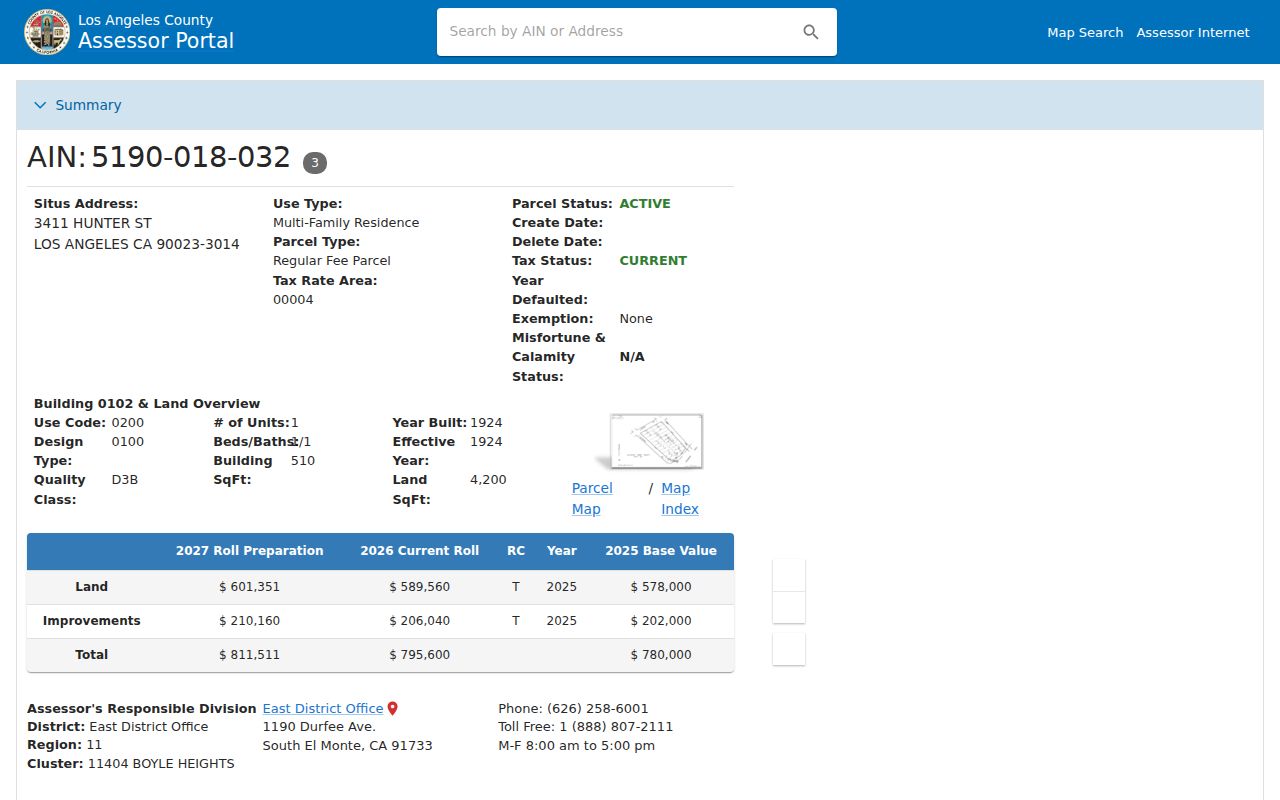
The card adds use code, design type, quality class, units, beds, baths, building and land square feet, year built, dimensions, and site flags. Roll detail may link a recording date, document number, document type, ownership-change code, and percentage. The public card omits owner name and mailing address. An exemption flag is not proof that the owner lives at the situs.
Note: Treat the AIN as the stable bridge among parcel, planning, permit, tax, and deed references, while recording the source date for each result.
Los Angeles Street Address Terms
Address records use short terms that answer different questions. A clean street directory keeps them separate before names are compared. A deed may identify the same ground through a legal description even after a street number or municipal boundary changes.
- Parcel
- A mapped unit of land identified by an AIN, with its own assessment and physical characteristics.
- Situs address
- The physical location assigned to the parcel, used to find the place on a map or search form.
- Mailing address
- The destination for an owner's tax or assessment correspondence, which may be different from the situs.
- Legal description
- The tract, block, lot, or other written land identity used in title records and resilient to street renaming.
- Plat
- A recorded map that lays out lots, blocks, streets, and related parcel boundaries.
- Criss-cross directory
- A reverse directory that starts with a street address and supplies a listed resident, householder, or business.
Mailing data can locate correspondence, but it does not establish a home. A legal description can join an old deed to a current parcel. A criss-cross listing is time-bound and can have omissions or OCR errors.
Los Angeles Street Records
Los Angeles record sets begin with an address or parcel, but each has a different output. The table separates the street signal from the access limit.
| Record set | Keeper | Street-level signal | Access path and limit |
|---|---|---|---|
| Assessment parcel | County Assessor | Situs, AIN, legal description, values, improvements, year built | Free web card; owner and mailing data use non-web channels. |
| City parcel and planning | Los Angeles ZIMAS | Adjacent parcels, zoning, cases, districts, and overlays | Free web viewer; not an owner or occupant directory. |
| County parcel map | LA County Planning GIS-NET | Unincorporated parcels, layers, queries, and nearby geometry | Free viewer; county geography differs from city geography. |
| Recorded instruments | RR/CC Recorder | Grantor, grantee, legal description, and title chain | Name/year office index or copy order; no address index. |
| Permits and inspections | LADBS | Work, parties, contractors, dates, and inspection events | Web reports or records request; a filing party is not a resident. |
| Tax account | Treasurer and Tax Collector | Bill, payment, and delinquency context | Address or AIN search; tax data do not establish occupancy. |
| Reverse directory | LAPL and Tessa | Listed occupants or businesses in address order for a year | Historical, periodic, and vulnerable to omissions or OCR errors. |
The AIN joins current parcel evidence. A street name is a clue, but legal descriptions and recording references are stronger after a number, suffix, or jurisdiction shifts. The county property-tax portal adds payment context, not a household roster.
Los Angeles GIS Street Walk
City and county maps serve different ground. ZIMAS supports property address, street intersection, APN, case number, community plan, council district, certified Neighborhood Council, PIN, legal description, and MapSheet searches. Its parcel view returns zoning, land use, cases, entitlements, district geography, and permit or code links. Click the highlighted parcel, then inspect adjacent polygons.
The LA County GIS-NET Public viewer fits unincorporated territory. It adds address, AIN, intersection, and community searches, plus layers, identify, query, buffer, measure, report, print, and export tools.
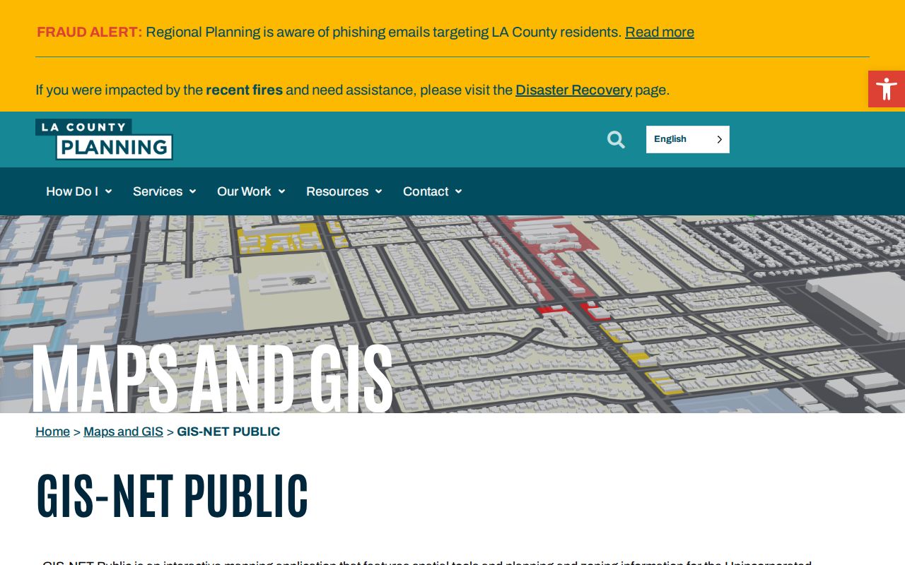
Do not label every GIS-NET parcel as a City of Los Angeles parcel. Use ZIMAS and the Assessor map for city addresses, and GIS-NET for unincorporated land. Neither viewer supplies a people list, and no official ZIMAS radius or buffer feature was verified.
Note: Confirm municipal jurisdiction before sending a planning, permit, tax, deed, or records request to the wrong custodian.
Los Angeles Permit Records
Permit history adds dates and named participants to a parcel trail. Los Angeles Planning Case Information accepts an address, case number, and related criteria. It can show an applicant, representative, case, or parcel history, but not an occupant.
The planning address search is useful when a street question turns on a case or entitlement tied to a parcel.
The planning view keeps the case search tied to an address or case, rather than to an assumed resident.
For building work, LADBS Online Services provides address or Assessor Parcel Number permit and inspection queries, reports, and available scans. If a PDF is absent, email Records.LADBS@lacity.org or visit Metro, 201 N. Figueroa St., first floor room 110, or Van Nuys, 6262 Van Nuys Blvd., second floor room 251. The custodian number is 213-482-6770.
The LADBS address and inspection service shows the kind of property-specific record trail that can fill a gap between a parcel card and a deed.
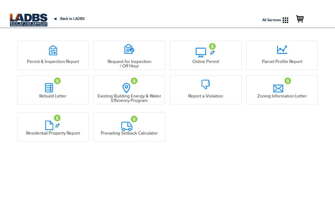
Permit parties are tied to the filing date and project. Read the document, date, and description before drawing a conclusion about a street household.
Los Angeles Deed Records
The Los Angeles County Registrar-Recorder/County Clerk holds deeds, deeds of trust, liens, reconveyances, and maps from 1851-present. They are public, but alphabetical grantor and grantee indexes are not online. The RR/CC instructions direct researchers to Norwalk, where indexes use party name and recording year. There is no address, AIN, or telephone index search.
Obtain the AIN, legal description, and current owner first. At Norwalk, search the owner as grantee in the likely acquisition year, record the grantor, date, document number, and legal description, then move backward. A similar name without matching land is not a valid link.
Viewing is free by appointment. Material from 1851-1957 is on the lower level; 1958-present is on the second floor. The counter is Room 2207, 12400 Imperial Highway, Norwalk, CA 90650, Monday through Friday, 8:00 a.m. to 5:00 p.m. The recorder/clerk number is 800-201-8999. RR/CC will not search the index by phone.
Known documents can be ordered online, by mail, fax, or in person. Plain copies cost $5 for the first page and $3 per added page; certified copies cost $6 and $3. Online orders may take up to 20 working days, and the full document must be purchased. Mail index requests with the name and year to Real Estate Records, P.O. Box 1130, Norwalk, CA 90651-1130.
Note: The physical split between 1851-1957 and 1958-present is an access clue, not an online digitization cutoff.
Los Angeles Reverse Directory
Historical reverse directories turn a street number into a time-stamped name clue. LAPL holds Los Angeles city directories in paper and film for 1873-1942, while Tessa's digitized selection spans 1875-1987. ResCarta reverse runs are especially useful for 1906, 1927, and 1956-1987. Later Haines and Pacific Bell address directories are also in Central Library reference stacks.
In ResCarta, an address search may require literal h for householder or r for resides, plus period abbreviations. Try “Ave 64” and “Avenue Sixty-Four,” or “Bway” and “Broadway.” Open nearby page images because OCR can miss a number. Check the volume's front matter first.
A reverse entry may list a resident, householder, business, spouse, or address, yet omit a household or reflect a business address. Pair it with deeds for ownership and census records through 1950 for household composition. The broader collection trail belongs with the City Directories resources; a current name question belongs with Resident Lookup.
Los Angeles Street History
Street names and numbers can change under a stable parcel. One cultural-heritage record documents a 1912 wholesale matching and renumbering change involving 1542 McCadden Place. Compare the directory street section with the legal description, AIN, Sanborn index, and LAPL's Street Names of Los Angeles.
Former municipalities add another layer. Hollywood consolidated in 1910, Sawtelle in 1918, Eagle Rock and Hyde Park in 1923, Venice in 1925, Watts in 1926, and Tujunga in 1932. A directory or permit may use an older jurisdiction or neighborhood name, so copy the source's exact wording.
The Bureau of Engineering address dataset is refreshed daily and exposes a house ID or PIN, house number, direction, street, suffix, and ZIP. For a rejected address, normalize the suffix, test the historical name or number, try an intersection or map, and carry the AIN forward.
Los Angeles Voter Records
The LA County voter verification form is a four-field self-check, not a public by-street directory. It requires last name, full birthdate, residence house number, and ZIP Code. Assistance is 800-815-2666, option 2. A street address alone cannot reveal registered voters.
| Field label | Type | Required | Format note |
|---|---|---|---|
| Last Name | Text | Yes | Alphabet only. |
| Birthdate | Date or text | Yes | mm/dd/yyyy. |
| House Number | Numeric text | Yes | Residence number only. |
| Zip Code | Numeric text | Yes | Five digits. |
Elections Code sections 2188 and 2194 limit full-file access to election, political, scholarly, journalistic, or governmental purposes and bar commercial use. Los Angeles County lists a $146 countywide file, $54 for a precinct, district, or city file, and $39 for an additional file. Orders go by mail or in person to Election Information, second floor room 2013, 12400 Imperial Highway, Norwalk, with a signed permissible-use certification. Government Code section 7924.000 protects home street address, phone, email, precinct number, prior registration, identifiers, and signature. Elections Code section 18109 makes knowing use outside permitted purposes a misdemeanor.
Note: Historical California voter registrations from 1900-1968 are available through Ancestry Library Edition at LAPL, not through the current self-verification form.
Limits of the Los Angeles Street Directory
Even a matched address chain cannot identify every person connected to a place. The Assessor web card omits owner and mailing information. A deed names instrument parties, not every occupant. A permit names project participants at a filing date. A reverse directory reflects one publisher and year. Utility lists and DMV residence data are not public rolls, and Safe at Home participants use protected substitute addresses.
Lawful personal use. Los Angeles street and address records may support genealogy, property history, or civic research. Do not use an address trail to stalk, harass, intimidate, or harm anyone, and keep any voter-file access within its certified lawful purpose.
A result names the custodian, date, address key, and record type, then states what remains. For a historical household, compare directory years, census pages, newspapers, and deeds. For a current parcel, confirm jurisdiction in ZIMAS or GIS-NET, then verify the fact with its custodian. That keeps a Los Angeles street directory useful without turning partial evidence into a claim about a whole household.